Coast to Coast Ride

Sunday, June 24, 2007


June 23 Missoula Montana 61 miles 5:32 riding

Thirteen miles and 1500 feet to Lolo Pass. We're getting stronger. The climb was not as difficult as it would have been a couple of weeks ago.

Lunch at Ft. Fizzle. The cavalry built a fort to halt the fleeing Nez perce. The Nez Perce rode around it.

Rest day in Missoula. Ran into fellow Alamedan Dave Wainwright in the street. He's riding coast to coast in segments. He'll ride with us tomorrow. Minor service to bikes.


June 22 Powell Lodge 40 miles 3:58 riding

We have been warned to hug the white line at the side of the road at peril of our lives. The road is narrow, very little shoulder, and the drivers are either truckers in a hurry or RV drivers gawking at the scenery. We had some luck. We passed a road work crew painting center lines on the road. The flagperson stopped traffic for half an hour at a time. Instead of having intimidating traffic overtaking us, we had no overtaking traffic at all for half-hour intervals. The campground was downhill from the road. We couldn't bear the thought of having to come back up, so we stayed at the lodge.


June 21 Wilderness Gateway Campground - Lochsa River 49 miles 5:23 riding
We have 103 miles of virtually uninterrupted climb to Lolo Pass. Fortunately, the grade is steady and gentle along the Clearwater River, its tributary, the Lochsa, and its tributary, Crooked Fork Creek. We make good time. We occasionally see rafting parties on the river. I bought two big cans of beef stew at Lowell over the hooting of my companions. They were glad to see it on the stove by the time we arrived at camp. We cooled off in the Lochsa. Our neighbor in camp is a professional fly-tier. He scrapes a few hairs off a piece of deer skin, adds a few hairs from a cow's tail, finishes with a sliver of a feather from a rooster grown specially for the feathers. He does a little trimming and the lure is done. This ride completes the first thousand miles!!!

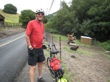
June 19 White Bird 65 miles 5:15 riding


June 20 Kooskia 50 miles 5:23 riding


In spite of the anxiety I expressed at my last posting, getting to White Bird Summit turned out to be a piece of cake.


We followed the Salmon River all the way to White Bird. We crossed the 45th Parallel, halfway to the North Pole. The North Pole seems closer than Boston. We passed a compound where some people are waiting for the end of the world. Just past Lucille, an old guy in a torn t-shirt waved us over to point out his friend in the river. The friend was using scuba gear to work an underwater dredge to extract gold. Watching this heavy work in icy water, I asked if the operator makes a living at this. "He doesn't really have to. He's on Social Security disability." was the explanation. Our tax dollars at work. The guy who waved us over is a local miner. He inherited a claim from his father. He's researching whether the claim antedates Idaho statehood. If it does, he says, he owns the bed of the Salmon River up to the highwater mark. I asked what he could do with the bed of the Salmon River. He's not sure, maybe trade it to the State for something else.


It was 102 when we reached White Bird. It's just a bend in the river deep in a canyon. It has the historical importance of being where the cavalry commenced the war against the Nez Perce Indians, but that translates in economic importance into one motel whose best days are behind it, one bar, and one cafe. My expedition into the bar convinced me it would be a good place for a stranger to be on his best behavior in.


New Highway 95 bypassed White Bird (on a bridge soaring about 200 feet above actually) leaving old Highway 95 to wind back and forth across the canyon wall in at least a dozen switchbacks. We got started at 5:45 to beat the heat. In three hours on the road, we saw exactly two cars. 6650 turns of the crank later (according to my fancy odometer), we were at the top. We ran into Ed along the way, riding in the other direction. Ed is going coast to coast in annual segments. He is in remission from cancer. His advice is "Live for today." There's a lodge at White Bird Summit. We stopped to beg for a couple of Cokes and chatted with the proprietor. I asked about the stack of strange-looking items stored in a barn. She paints natural rock surfaces with some latex material, then peels off the dried latex to use as a mold. When a museum wants real-looking rock surface for a diorama, they call her and choose the model they need.


Do not stay at the Bates Motel. Do not stay at the campground at Kooskia, Idaho.


Roy ordered a baked potato with his dinner. When we all gaped at the watermelon-sized potato, the waitress remarked, "You're in Idaho now."


Monday, June 18, 2007


June 18 New Meadows 47 miles

Mesa Orchards was the largest apple orchard in the US under single ownership, 1400 acres. It stopped operating in 1960; now there isn't an apple tree to be seen.

We hung out for a while in Council. Michele checked out the quilt show. Meanwhile, His Honor Bruce Gardner, mayor of Council, stepped out of his vet practice across the street to chat with us. Council is, of course, home of the World Championship Porcupine Race each July Fourth. His Honor explained the fine points of porcupine racing. Kids capture the contestants in the hills up to 72 hours in advance by popping a trashcan over the porcupine. The spot of capture is flagged so that the rodent may be returned to its original location. Each porcupine rides a separate float in the parade. (Perhaps they get prickly if forced to share a float.) Sponsors may stake up to a couple hundred dollars on a speedy-looking porcupine. The race track is walled with plastic "utility mesh". Nevertheless, a contestant will squirm under the mesh into the crowd from time to time, increasing the excitement, if that is at all possible. The key here is that the porcupine badly wants to find a place to hide. A trashcan looks to a porcupine like a fine place to hide. The race begins by dumping the rodents out of their trashcans onto the course. One handler precedes the porcupine, dragging the trashcan in front of the rodent. The rodent runs for the trashcan. A second handler uses a broom to keep the porcupine focussed on task. You may still be able to get reservations, at least for the qualifying heats.

Two more long climbs this afternoon. I don't think they were all that challenging, but we're worn down and very butt-sore. There's a 3000-foot climb coming up from White Bird to Grangeville. We want to be rested going into it, but we won't reach White Bird tomorrow without a long day. If we don't reach White Bird, it's that much more to pedal before we even start the climb.


June 17 Cambridge, Idaho, 58 miles 5:57 riding

Yippee-ay-a! East along Pine Creek, we encounter three cowpokes herding about a hundred head along the highway. This is open range country. You hit a cow with your car, you bought the cow. (You hit a cow with your bike, you get laughed at.) Farther along, near Oxbow, we found the Idaho classic car club stopped at a remote gas station with just one pump. Eighty beautiful old cars. In Oregon, by law, only the gas station operator may pump the gas. The car club is probably still there, waiting for the last car to be filled. There were two flatbed trucks to pick up any classic cars that give up. How I long for the same for me.

The Snake River is contained by a series of dams along the Oregon-Idaho border. Short, very steep climbs to the level of each dam, followed by a more level stretch beside each reservoir. We finally cross a bridge into Idaho and then grind up 2000 feet through a lovely valley. It would be an exaggeration to say that we coasted the last fifteen miles down to Cambridge, Idaho, without turning the crank, but not by much.

Chicken-fried steak and cherry pie for dinner. We earned it!


June 16 Halfway, Oregon 55 miles 5:16 riding

We pedaled through Richland. There's little I can add to the picture. The Grange was holding a fundraiser picnic for the volunteer fire department - cheeseburgers and strawberry shortcake while local talent performed.

1100-foot climb, all in the sun, with some headwind, before a welcome descent into Halfway. (The spot was in the middle of the railroad line bringing ore down from the mine so they named it . . .) What a wholesome place! The name and picture of each member of the senior class at the highschool is proudly displayed on a lightpost. A storefront holds the photos of all of the community members serving in the military. The storefront is next door to the funeral parlor. For another contrast, I spoke with a man whose bumper sticker read, "Is it right for a vet to sleep in a cardboard box while a draftdodger sleeps in the White House?" while a few days ago I passed a sign advising that the community is a "UN-free zone".

Speaking of homelessness, we have developed more sympathy for the truly homeless pushing their basket of meager possessions. Since we are now living out of the equivalent of a couple of shopping bags, we are constantly picking up extra napkins and anything else that seems like it might be useful. I scavenged a clothespin at one campground that we use to dry socks.

Old friends George and Lynette live in Halfway. They fed us pancakes, muesli, eggs, and porkchops in the morning.

Friday, June 15, 2007


June 14 Austin Junction to Baker City 52 miles


Breakfast at the cafe (owners reported returning about 10:30). The owner/waitress recommended filling our water bottles at a spring a mile or so down the road. That turned out to be important because that was the last drinking water we saw for 51 miles.


At Tipton Pass, we encountered Dave Kohlmeier raising campaign funds in his race for a judgeship. He was picking up discarded aluminum cans. He's a veteran of the grocery business himself. I wanted to ask if he had, perhaps, attended law school, but the question sounded elitist. He hates Wal-Mart, so I was satisfied with his qualifications. Write to the Blue Mountain Eagle, the John Day newspaper, if you want to express your support for his candidacy.
On to Sumpter Pass and then downhill 31 miles to Baker City along the Powder River. Unfortunately, a fierce wind blew into our faces every foot of the way. I was in low gear. Michele pedaled close behind me for some relief from the wind. Roy, ruggedly independent, did his own. (I should mention that Roy has been amazingly powerful since we left Eugene. He races ahead of Michele and me and then stops to wait for us to catch up!) We dragged into Baker City around 5:30 after many rest stops. I was too tired to turn my head to spot the motel as we entered town. Roy loves architecture. He perked up with all the Victorian houses and 1890's store fronts. He pedaled about, exclaiming "Look at that!" to the other end of town. He came very close to a beating when I learned that we had to pedal back through town to get to the motel!
Dehydration is going to be a factor on long days in the high desert. Fortunately, yesterday wasn't all that hot. I still exhausted all three water bottles before I finished the day. I drank at least a gallon of liquid in the course of the day and woke up thirsty in the night.
June 15 will be a rest day in Baker City. My rear tire is worn down to the fabric. Michele is having some trouble with her gear shifters. The bike shop is looking into all three bikes as I write. Baker City has a charming downtown, snow-dappled peaks in the distance, a fine library for internet service. We will enjoy it.


June 13 Dayville to Austin Junction 59 miles 6:06 riding time

For 45 miles, we had a long slow ascent. At Prairie City, we had to make a choice. We could stay in Prairie City only at the cost of having three substantial climbs over 66 miles to Baker City the next day. The only stopping point between Prairie City and Baker City is Austin Junction. Austin Junction consists of a cafe/store/gas station at a "Y". The owners will let bicyclists camp behind the store if the owners are around. We already knew that (a) it was Wednesday and (b) the owners close up on Tuesdays and Wednesdays. But maybe they'll be there. There is zero cell phone service in Prairie City, but the ranger station called on the land line - nobody home. Well, maybe the owners will be there later. We decided to go for it. Dixie Pass is a 2000 foot climb in eight miles on top of 1000 feet over the first 45 miles. Sweet is my lover's kiss, but more welcome by far is the cooling touch of the wind on my wet back as we grind up the hill. We coasted down to Austin Junction. Nobody home but the guard dog! Not even a hose faucet for water! Roy reconnoitered while Michele and I grumbled at each other. Roy came back to report a nearby trail into the woods to a spot suitable for camping and a stream. We threw down our sleeping bags, boiled some water. Roy had a freeze-dried lasagna dinner which we served spooned onto slices of sandwich bread, followed by something labeled freeze-dried "chocolate decadence cheesecake" by some liar. Good stuff.


June 12 Mitchell to Dayville 42 miles 4:08 riding


A steep climb first thing made me regret eating all those pancakes. 1400 feet and a couple of hours later, we tipped over into the valley of the John Day River. John Day, incidentally, was never anywhere near Dayville, the town of John Day or the John Day Fossil Beds National Monument. His fur-trapping party was attacked by Indians, who took everything they had, down to their clothes. I guess this was good for a laugh to the other trappers. The river mouth where the event occurred became known as the John Day River and everything upstream wound up with the same name. We turned off our route a couple of miles to visit the National Monument. Unlike other national monuments, this is an active research facility where one might see fossils being preserved in the laboratory. It's one of the most important sites in the world because whole communities were preserved intact beneath mudslides. Something about the volcanic ash allows unusally precise dating of the fossils.


The Presbytarian Church in Dayville opens its doors to hikers. One may camp on the lawn or sleep on the floor of the social hall. There's a shower, a kitchen, a computer, a washer/dryer. Donations are gratefully accepted. The caretaker is a wheelchair-bound woman of maybe 50 or 55 who breathes with the aid of seven liters of oxygen per minute. She reports she is dying of some lung condition and that she is ready to go. Her children suggest that she move somewhere bigger (Dayville's population is under 200). The daughter adds, "Mom, I'm not going to care for you the way you did for your parents." So the caretaker has decided, no, she'll die in Dayville where she's at home.
The Dayville City Hall would probably fit inside my office. Roy found some rum at the Dayville Mercantile! We nuked a frozen pizza, chips and salsa. Ahh!


June 11 Ochoco to Mitchell 41 miles 4:05 riding
Started the day with an 1800-foot dose of Dr. Hill's Elixir of Health. Mitchell is a metropolis of 170 residents. In 1904, the entire town disappeared when a 30-foot flash flood passed through. Today, there is the Oregon Hotel and the Lone Pine Cafe with the famous ice cream pancakes (they melt ice cream in the microwave, then mix it with pancake mix to batter consistency and fry 'em up. They're pretty good.) We took rooms at the hotel, a friendly place with six or eight rooms and a shared bathroom. The school advertises for foreign students to help the school keep the doors open. Half the tiny student body is foreign, living in a dorm.

I'd like to put in a plea for a national standard for pancake size. The Lone Pine Cafe pancakes are the size of manhole covers. Pancakes elsewhere have been as small as a Mrs. Fields' cookie. How do you know how much to order? A national standard is the answer.

June 10 Sisters to Ochoco State Park 51 miles 4:04 riding


Easy cycling along the Crooked River. We're into mesas now. Lunch beside a canal.

Picked up a roast chicken and fresh veggies for dinner in Prineville. Camped at Ochoco Reservoir. A million stars.

Tuesday, June 12, 2007


June 8 Eugene to McKenzie Bridge 58 miles 5:23


Touched by Angels - We followed the McKenzie River through pleasant country up to McKenzie Bridge in good weather. McKenzie Bridge consists of a store and a few rental cabins. We wanted a room because the weather report promised rain soon. None to be had. Gary and Joyce, a retired couple, chatted with us and then opened their home to us. We camped on the lawn, showered. Roy helped Gary drink some beer. Gary and Joyce loaned us their car to drive to the nearest restaurant a few miles back down the road (they had already dined)! Joyce fed us strawberry shortcake for dessert and excellent pancakes and bacon and eggs for breakfast. Kindness to strangers is still to be found!


The Ordeal! June 9 McKenzie Bridge to Sisters 44 miles 5:48 riding time


McKenzie Pass is about 4500 vertical feet above McKenzie Bridge. Highway 242 is closed to automobile traffic at this time of year but open, sort of, to bikers. It's 22 miles from the turn-off to the top. Eleven miles up, there is a gate to close the road. We had to push the bikes through the woods and over a steep rocky berm to get around the gate. By then the weather had turned to drizzle and intermittent rain. I was in granny gear pretty much entirely from the turn off to about Mile Sixteen. We were reduced to pedaling for about fifteen minutes, rest for two or three. You should understand, this is wilderness - no houses, no cars, no nothing out there. At Mile Sixteen, there's a guy inexplicably walking two little dogs who says "You're okay. The road plateaus in about two blocks." Two minutes later, we're on flat road for three or four miles! Back to granny gear for the last few miles to the top. The pass is a lava field, an expanse of crazily broken stone with scattered snow patches remaining. There's an "observatory", a stone structure with openings to direct the view to the Three Sisters peaks and others. With the clouds and rain, we could see almost nothing. There was a young girl at the pass who cycled up with her father, wearing just a cotton t-shirt and skimpy shorts. She was turning blue, so Michele gave her a shirt to wear to get back down in some comfort. We huddled behind the restroom for some shelter from the wind to eat a snack before heading down. When we got to Sisters, the annual rodeo was on. We were grateful to get the last motel room.

Thursday, June 07, 2007

I have managed to post a few photos at flickr.com. Search for alamedaflickr.


Monmouth to Eugene: Overcast . . . Rain . . . Overcast . . . Rain . . . Hail . . . Rain . . . Hail . . . Motel! 62 miles

A 24-hour flu caught up with Roy when we arrived in Eugene. Twenty-four hours later, he was recovering and Michele came down with it. We'll take an extra rest day for recovery.

Roy and I bought new, more padded saddles. All three of us had unpadded leather saddles. They are supposed to be the most comfortable once they have broken in and conformed to the rider's butt. I have most of a thousand miles on my saddle and the only conforming occuring is my butt to the saddle. Enough!

I am told that McKenzie Pass is open to bicycles, but not to cars. The highway department plows one lane through to accelerate the snow melt in the pass and then waits for the sun to do the rest. That may be a while in this weather. We want to cross the pass before the road is opened to cars. The road is steep and narrow; the bicycles are slow and wobbly on the climb so the climb will be much more enjoyable without cars squeezing by us. Especially with two recovering from the flu, I'd like to break the climb into two days. I hope to ride as far as the McKenzie Bridge ranger station tomorrow to inquire about conditions. There is a Two Buttes campground about halfway up. If that campground is open, we'll stay there unless the weather will make camping miserable.

We will be leaving the coastal forests. I can't go without saying a word about clear-cutting. I don't understand the economics of logging; maybe there's some justification for clear-cutting. The effect is appalling. We often emerged from forest so thick that one can imagine dinosaurs roaming in it into a hillside clearing where there is nothing but grey and brown. Not even weeds are standing. To my surprise, there would sometimes be some remaining logs of up to maybe six inches in diameter lying about. Perhaps they aren't worth hauling away even though they were cut down. I can't believe this is the best way to manage our forests.

Monday, June 04, 2007

Ft. Stevens State Park - Melinda threw our gear out of the van, locked the doors, and drove off with our wailing and pleading and threats loud in her ears. There was nothing for it but to start riding. We visited Ft. Clatsop State Park, where Lewis & Clark wintered-over, then got down to pedaling. Some up and down as the coast road touches the surf and then climbs over a headland (or tunnels through in one case) to return to the surf. By arrangement, we met with my brother at Nehalem Bay State Park. He and his wife had their RV parked and fed us an excellent dinner. They refused to give us a ride, however. Raccoon burglarized my pannier - no more granola for breakfast. 51 miles.
Continued along the coast or inland parallel to the coast to Cape Lookout State Park. Freeze-dried unidentifiable substance for dinner. 39 miles. Generally cool to cold and somewhat windy.
Further down the coast and finally turn east to reach Rose Lodge where our map promised a campground. One might easily come to the conclusion that the entirety of Rose Lodge is a convenience store whose inventory consists of cold beer and Twinkies, nothing else. At the store, the clerk and some locals agreed that there is no campground in Rose Lodge. We trudged on and quickly found the RV park that serves as a campground. I guess that I have to be more general in how I ask the locals about lodging. We were welcomed at the RV park. The proprietor directed us to the one remaining commercial element of Rose Lodge for food. That was the Tackle Box, a bait shop with some grocery contained in a space of maybe 300 square feet. I went in and asked for some sausages to cook up. The owner thought for a while and then agreed he had some sausages. He went to the ice cream case, took out the trays, and dug out of the bottom a cardboard box with some loose, freezer-burned sausages. He grabbed a big handful and asked, "What do you say to three dollars?" A deal was made. We fried them up along with a load of garlic chicken Rice-a-Roni and ate like kings. 42 miles.
It rained overnight. Fortunately, Roy heard a weather forecast. The RV park had a shed where we sheltered the bikes. A light rain fell all night, tapering off at dawn. I'm glad we didn't have the rain any earlier in the trip - the cold wind was bad enough. Rain on top would have been pretty disheartening. We packed up the wet tents. Granola bars for breakfast with the expectation of a hot meal over a big hill and ten miles away. The one building was boarded up when we finally got there. Well, okay, then we'll go another eight miles or so to Grand Ronde for breakfast. No cafe there either! Finally found an Indian casino just before Ft. Hill. Roy and Michele went in for a serious breakfast. I was less hungry and I was also afraid to leave our stuff at a casino, so I sat outside with the bikes and made a sandwich. Every logging truck in Oregon is on this road. The shoulder is wide enough, but there's a ton of gravel thrown onto the shoulder so you're forced toward the traffic lane. It's pretty scary. We met a British cyclist just finishing his coast-to-coast ride who said this stretch is the worst of the whole ride. We've left that behind. We have a motel in Monmouth, Oregon, tonight. About 44 miles.